
NEWARK AIRPORT CITY
Newark, NJ
Newark, NJ
Spring 2020 Interdisciplinary Urban Design Studio // Critic: Marilyn J. Taylor
Team Members:
Team Members:
Xiangyu Chen, Mary A. Eveleigh, Claire Jaffe, Amie Patel, Justin Ritchey, Robert I. Romo, Daniel D. Shin, Yuqi Song, Tobin Stuff, Yiding Wang, Liuqing Yang, Yijing Zhang, Zixuan Zhou
The following images are excerpts from the Spring 2020 Interdisciplinary Urban Design Studio final report, which is embedded above. The studio focused on a new future for the Newark Liberty International Airport and the City of Newark. This future would be defined by connectivity and inclusion by joining the site's existing rail infrastructure with a new central concourse for the airport. The studio addressed how this multimodal transportation facility should be designed and how it would impact the lives of the people of Newark and the New York metropolitan region.
My individual project focused on the future of the current AirTrain and station that links regional NJTransit and Amtrak riders to the airport. Within the framework of connectivity, equity, and resilience, this project reimagines the station as a connector and hub for activity that is focused on the surrounding community. It also repurposes the AirTrain infrastructure as an active recreation piece of infrastructure dubbed the "AirTrail." Together with other students' proposals, this proposal aims to create stories that will define this place as one with a sense of arrival.
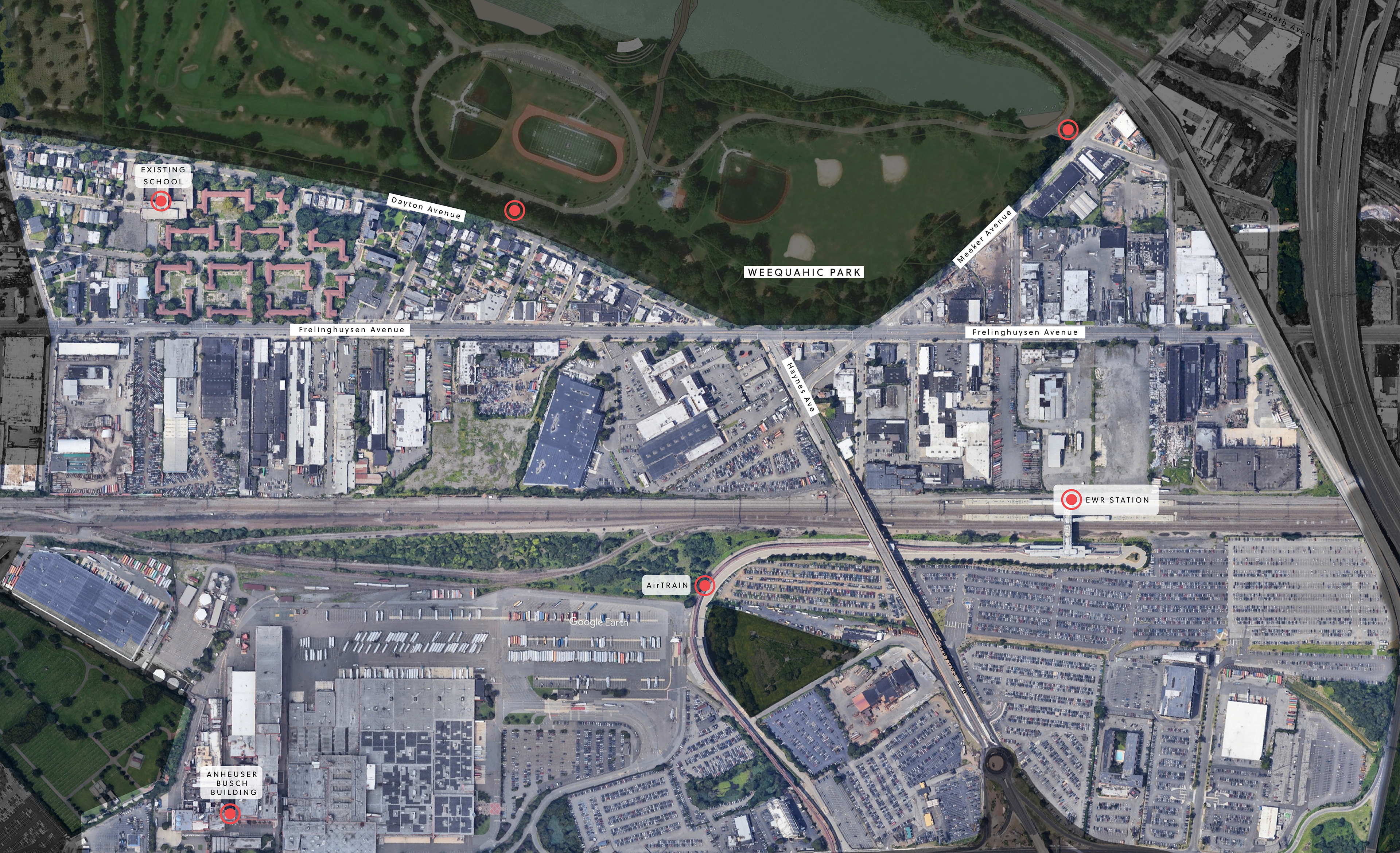
Existing Site and Context. The focus area of our studio was between the Newark Liberty International Airport to the east and Newark's Weequahic Park to the West. Important corridors of travel within the site include Frelinghuysen Ave. and the NJ Transit / Amtrak rail corridor.
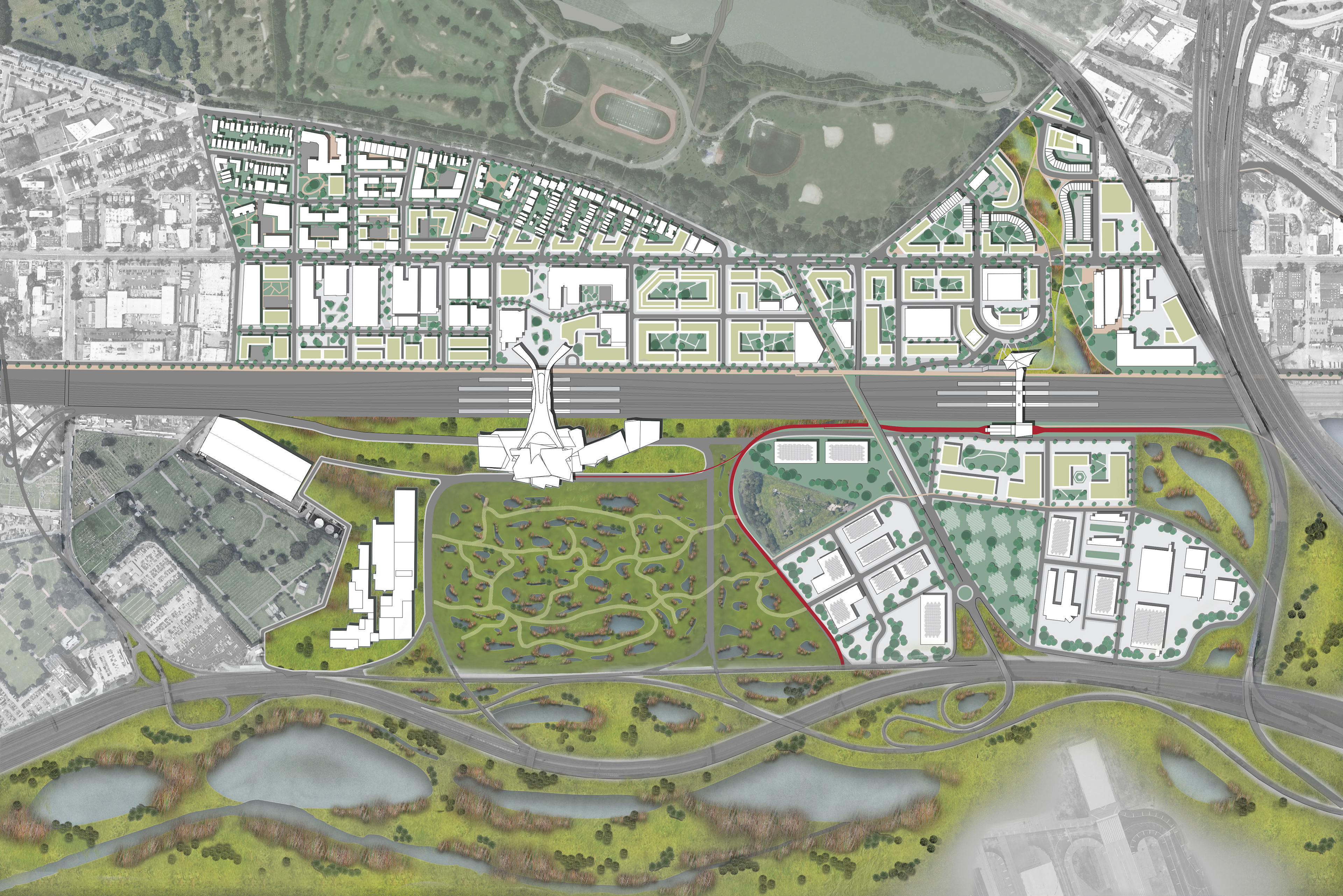
Newark Airport City Area Master Plan.
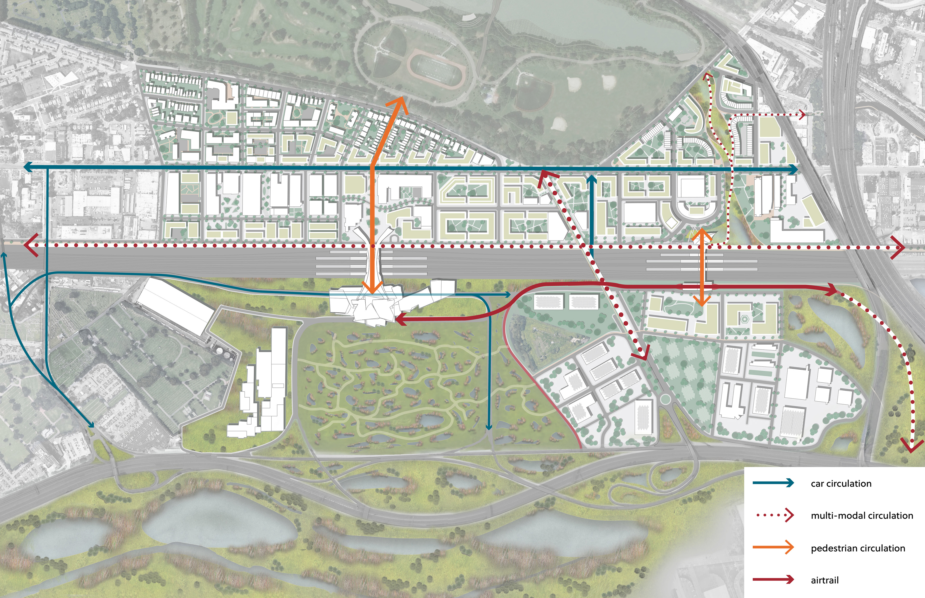
Connectivity Diagram. Site analysis and research shows the rail corridor to be a significant barrier to travel and access to economic benefits generated by the airport. Essential to the overall success of the plan was for each proposal to enhance or introduce a new means of connectivity for the site.
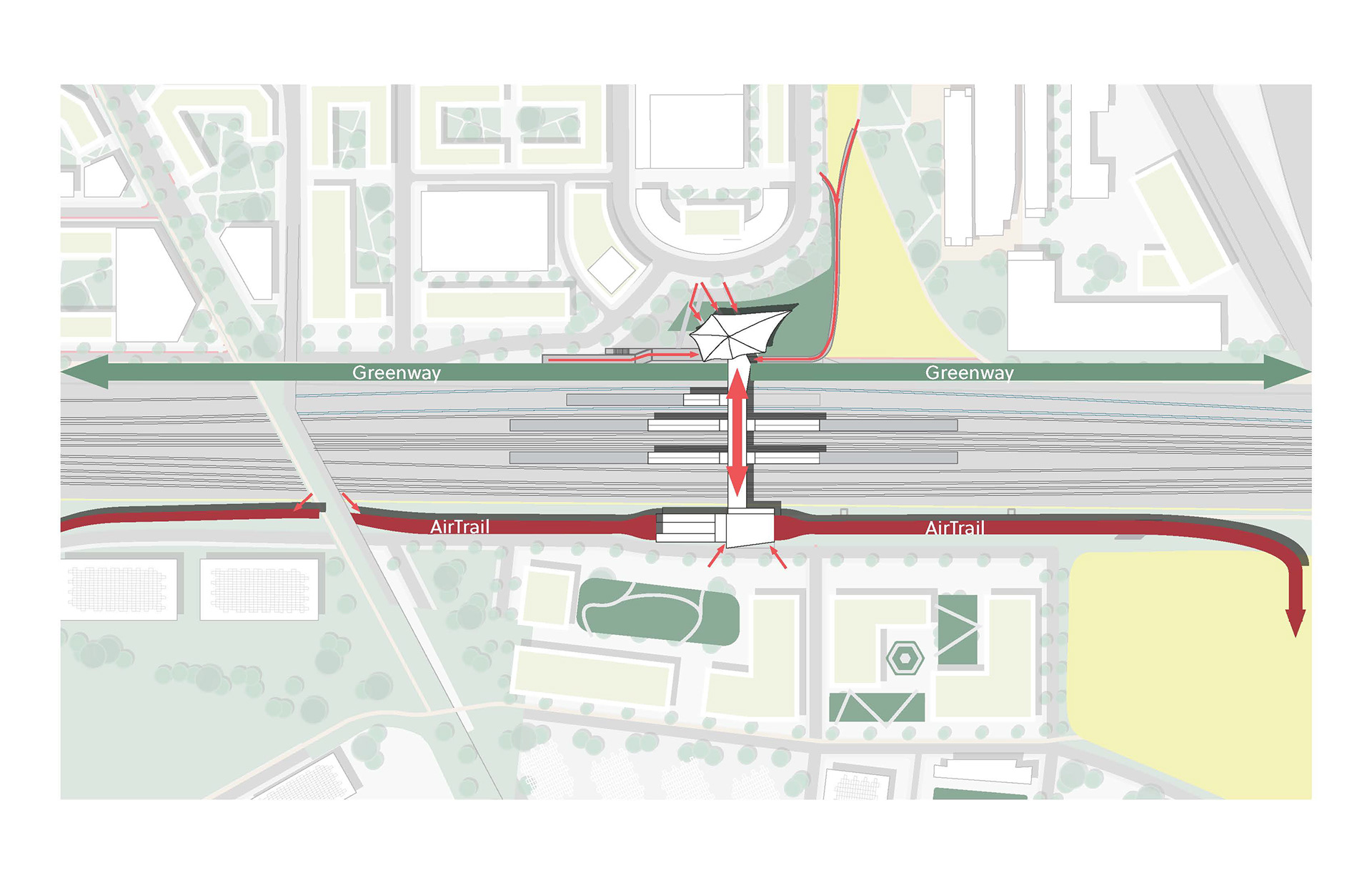
Area Site Plan of Weequahic AirTrail Station (formerly EWR AirTrain Station).
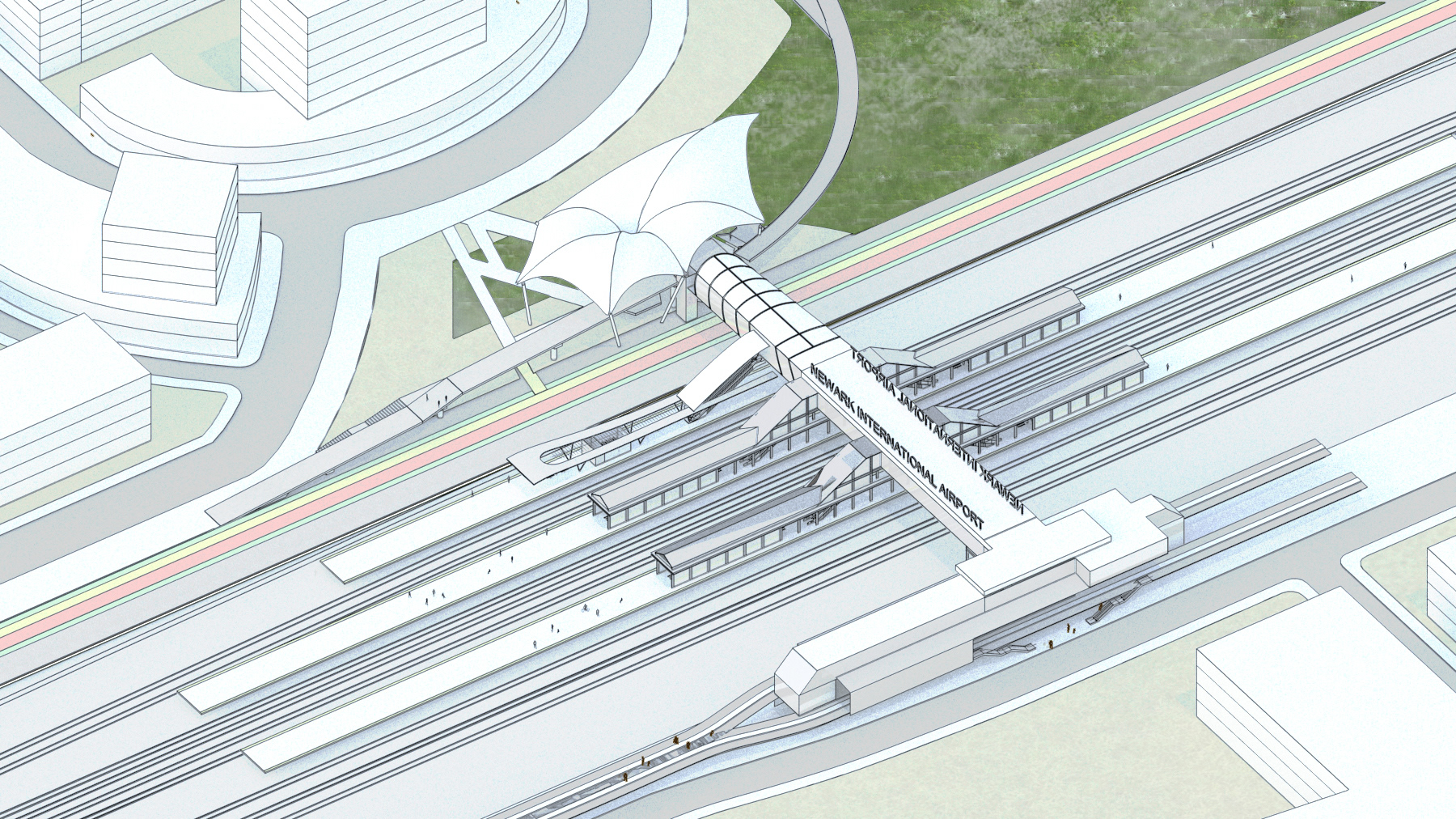
Axon of Weequahic AirTrail Station. Expanded local rail service via PATH will open new possibilities to this site and help transform this isolated single-purpose station into a catalyst for growth.
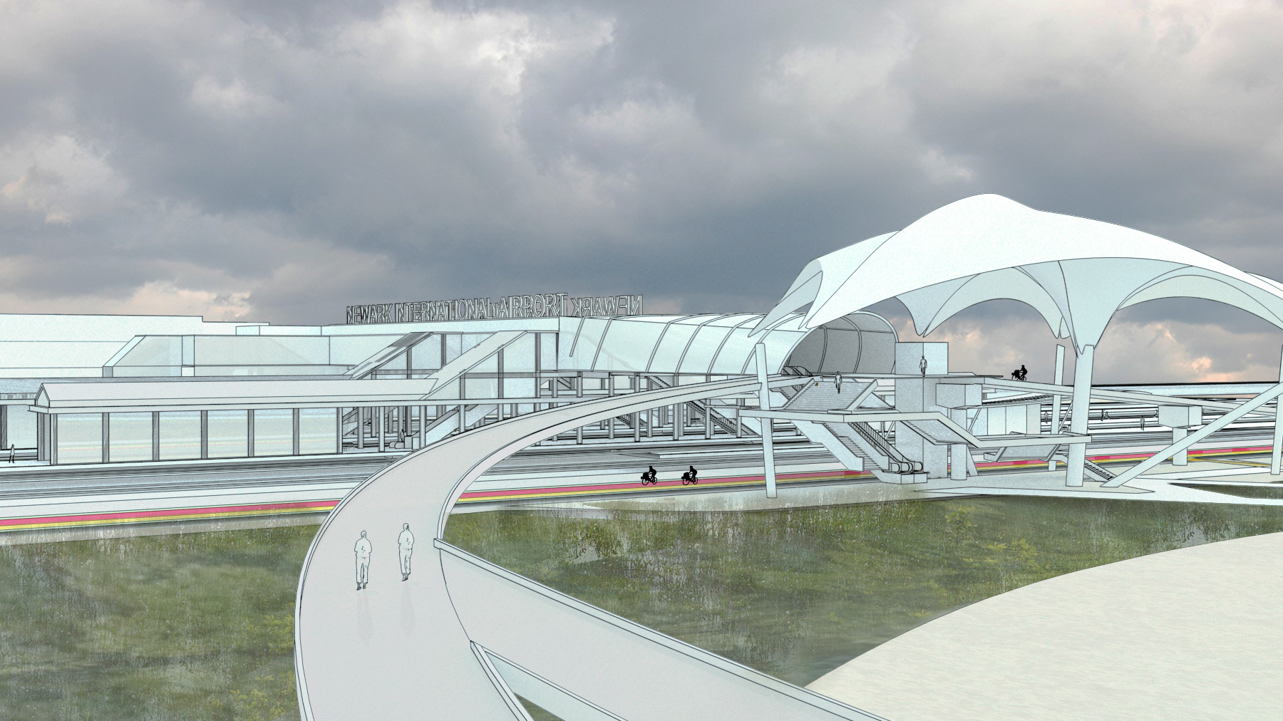
Perspective render looking west towards the Weequahic AirTrail Station. Wetlands restoration is a crucial step towards the resilience of this site and is seen here.
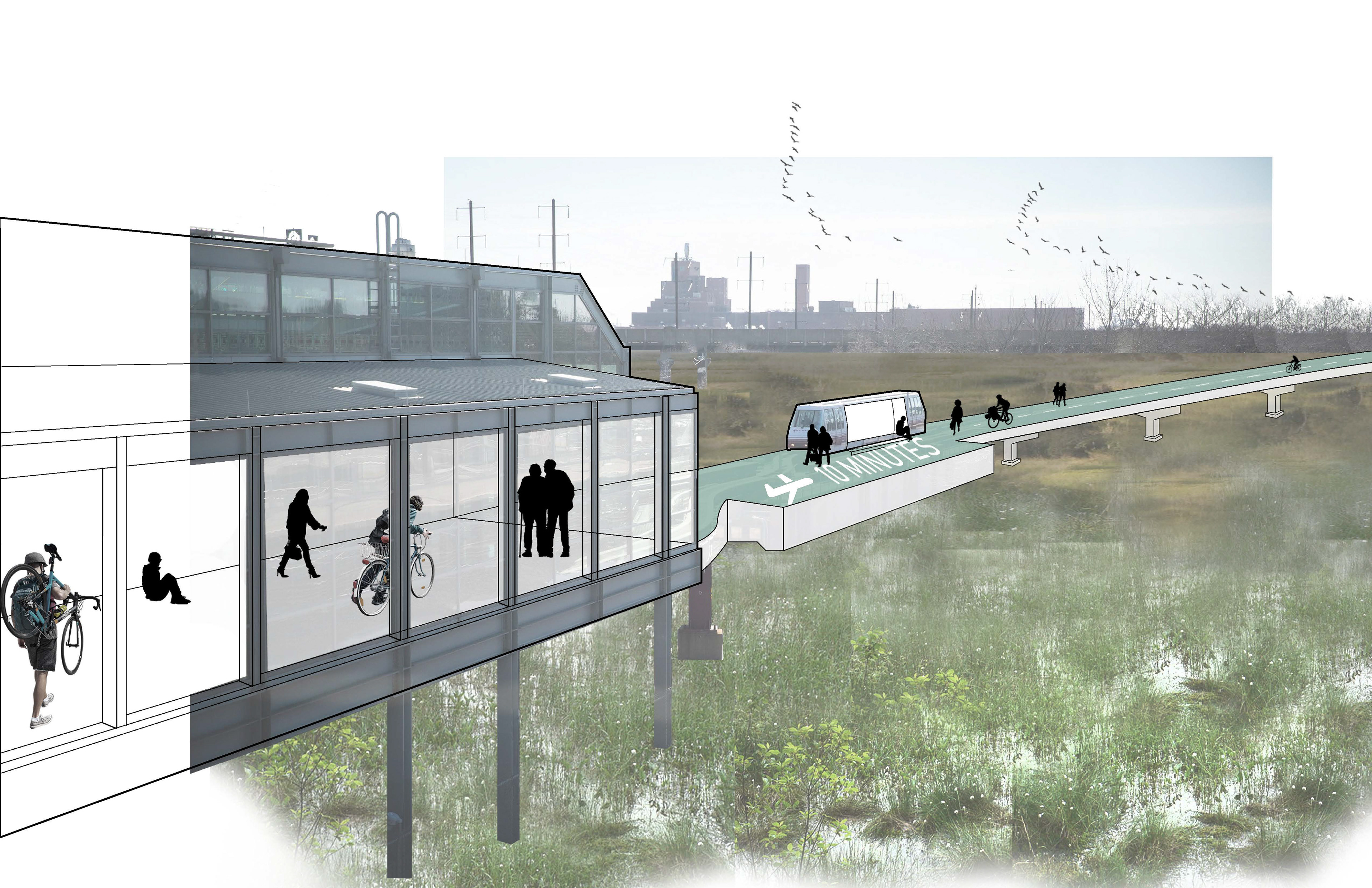
Rendering showing the defunct AirTrain infrastructure repurposed into an active recreation amenity for the surrounding community. The AirTrail also serves to bring the public into closer contact with the wetlands restoration initiatives crucial to the longevity of this place.